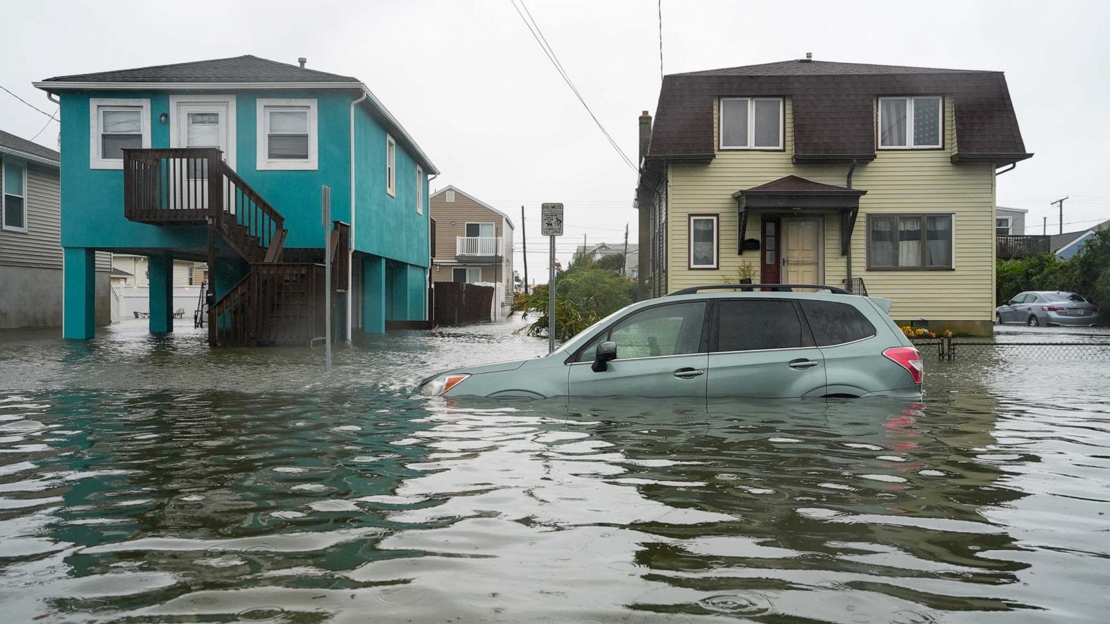
The early-season nor’easter hit the East Coast Saturday bringing in torrential rain, high winds and flood warnings for millions of people.
Streets in New Jersey and New York, which were under a state of emergency, were already flooded as the storm and high tide combined for dangerous conditions. Waves of 16 feet or more have been reported by buoys off the Jersey Shore and southern New England.
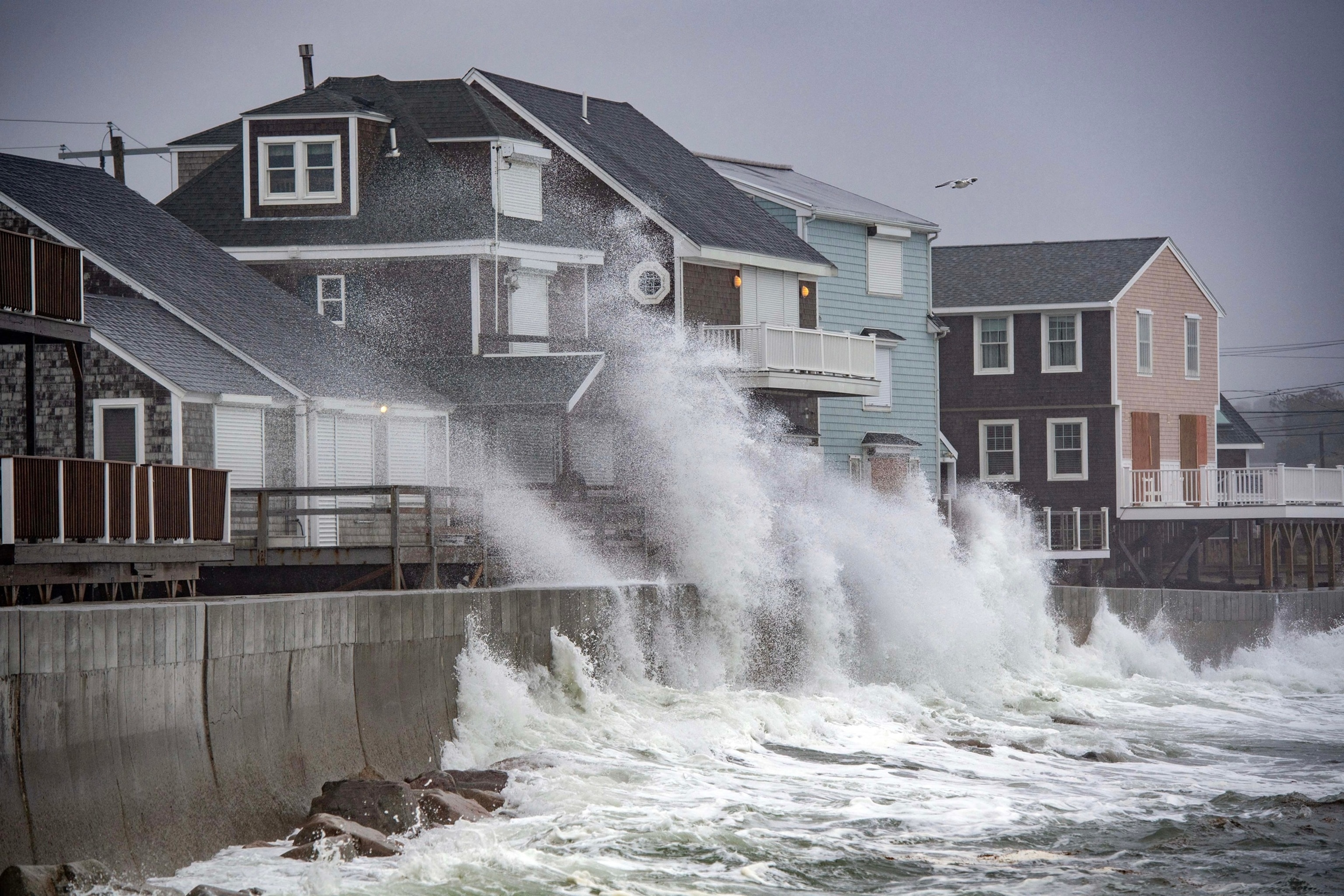
Waves pound the coast as the tide comes in during a Nor’Easter storm in Scituate, Massachusetts, on Sept. 26, 2026.
Joseph Prezioso/AFP via Getty Images
Late Friday night, a weather station in Surf City, New Jersey, reported a wind gust of 74 mph. Other stations along the Jersey Shore have reported wind gusts of 60 mph or more.
The winds toppled trees in New York City, with some landing on top of parked cars.

A fallen tree branch covers a car in Brooklyn, New York, on Sept. 25, 2026, as a nor’easter brings rain and strong winds to the area.
WABC
Tidal flood waters peaked at moderate flood stage late Friday rose ahead of high tide later Saturday morning.
New York Gov. Kathy Hochul, who already declared a state of emergency, told reporters Saturday morning that much more rain was coming.
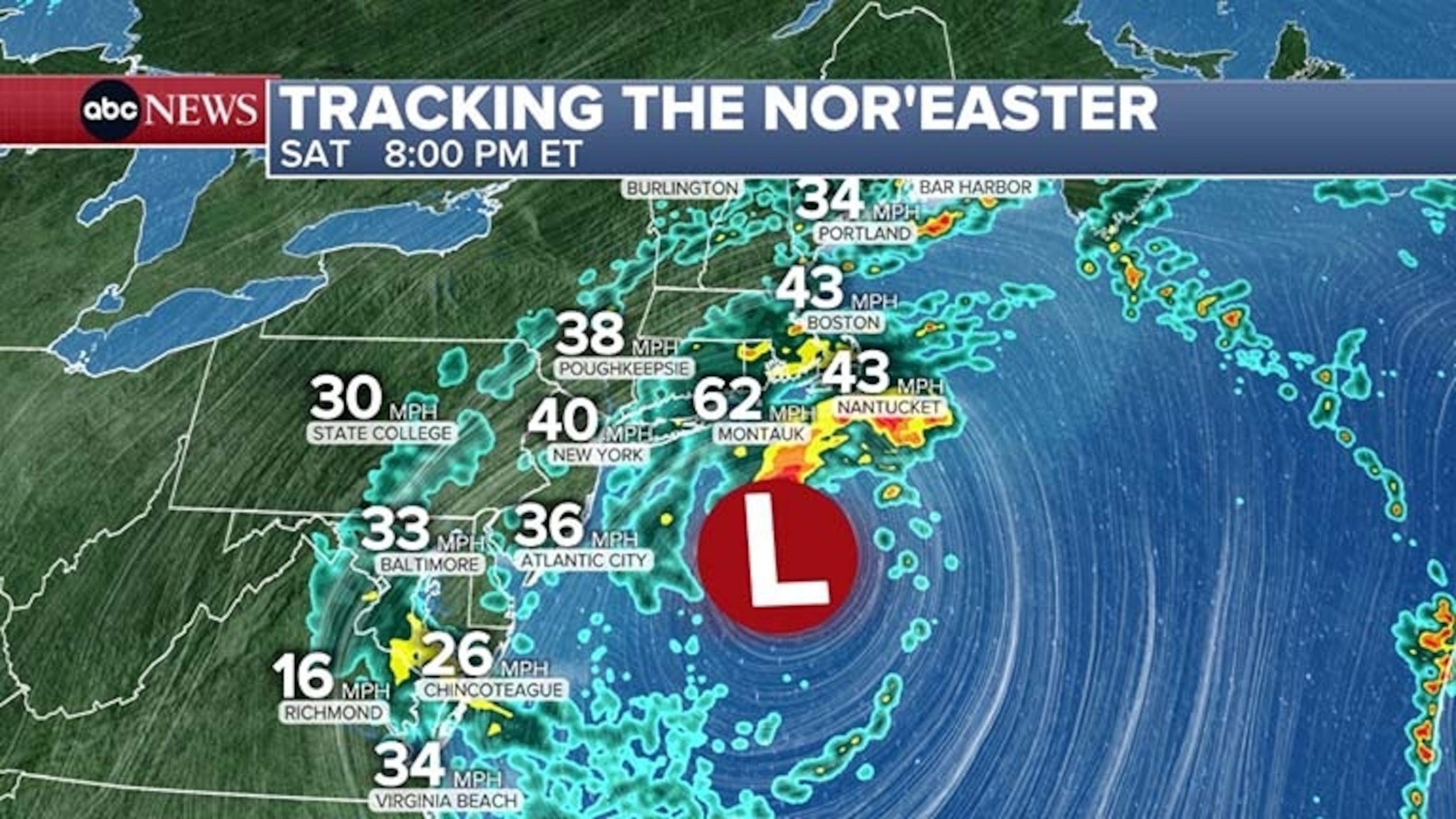
“With tonight’s full moon, the tides may even be higher. We expect waves as tall as 20 feet in some areas. Winds will be just as powerful as the waves, wind gusts exceeding 50, even 60 miles an hour, have already been recorded on Long Island,” she said at a news conference.
The governor added that power outages were expected throughout the state and warned residents to be prepared.
Subways and trains have been operating as expected so far, according to the governor. Storm doors have been added at rail yards at Coney Island and Howard Beach to reduce the chance of impacts on service, Hochul said.
“Here’s the bottom line: Stay out of the water. Although we just saw a surfer on one of the cameras off the coast of Long Island, stay out of the water,” she said. “Anyone who goes in or near the water this weekend is literally gambling with their life.”
Suffolk County Executive Ed Romaine told reporters that 17,000 residents have lost power in the Long Island county and he expects more outages over the next 24 hours.
“Montauk is getting hit with 50 mile an hour winds. Our concern is that trees will topple, and with them, power lines,” he said.
Parts of the southern Chesapeake Bay to the Jersey Shore and into the Raritan Bay reached moderate to major flood stage from coastal flooding during high tide Saturday morning. While the tide has begun to recede, some of these areas mentioned are still dealing with moderate to major coastal flooding.
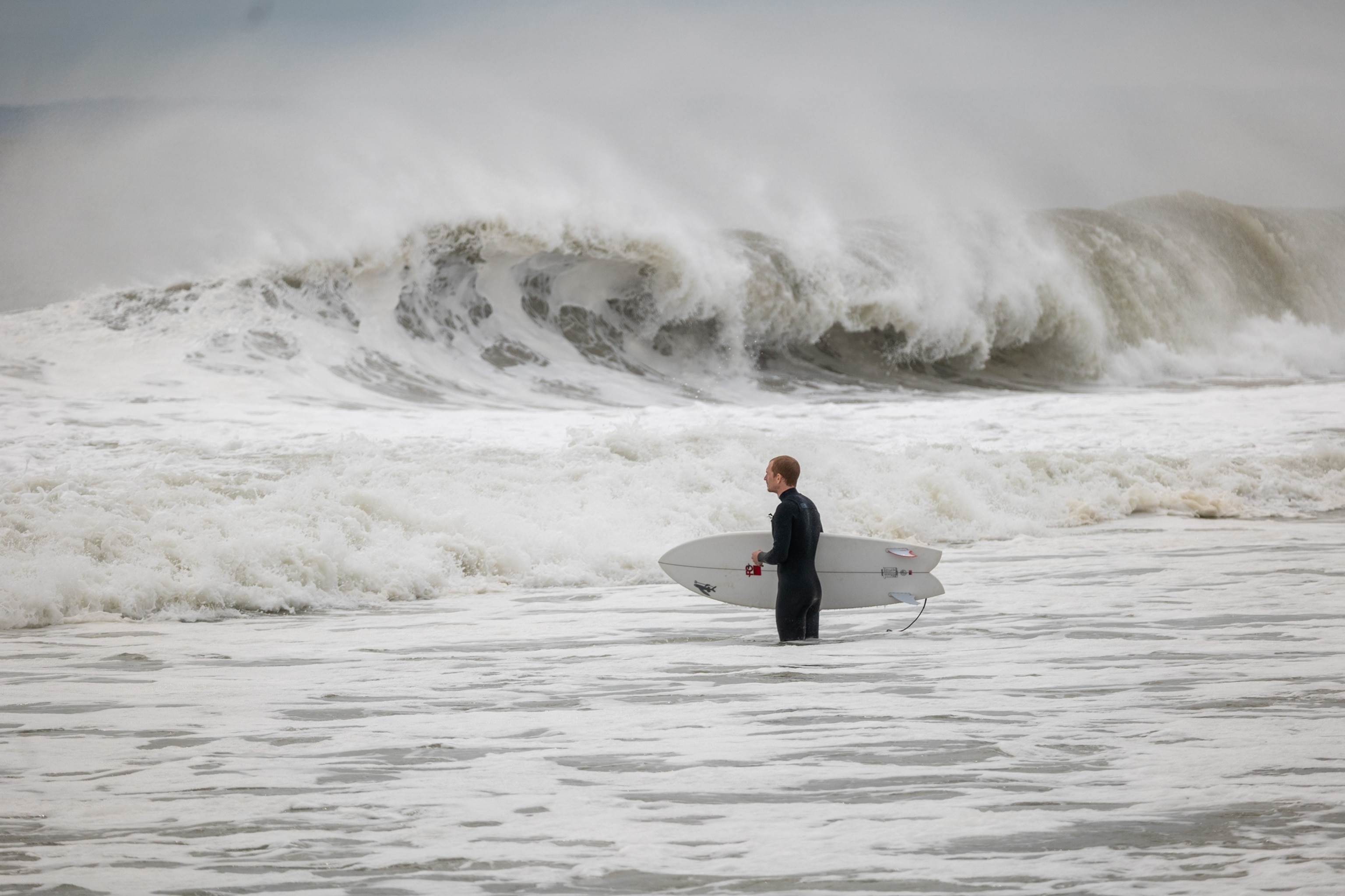
NEW YORK, NEW YORK – SEPTEMBER 25: Surfers take advantage of large waves along Rockaway Beach as a Nor’easter heads into the New York area on September 25, 2026, in New York City. Much of the Northeast is preparing for the storm, which is expected to bring heavy rain and high winds over the weekend.
Spencer Platt/Getty Images
Coastal flood alerts remain in effect from eastern Virginia through southern Maine, including Virginia Beach, Philadelphia, New York City, New London, Connecticut, Providence, Rhode Island, and Boston.
Moderate to major coastal flooding is possible during high tide later Saturday evening from the southern Chesapeake Bay to the Jersey Shore and up to Raritan Bay.
Wind advisories remain in effect from the Delmarva Peninsula up to eastern Massachusetts, including Dover, Delaware; Philadelphia; New York City; Hartford, Connecticut; and Worcester, Massachusetts, for winds gusting up to 45 mph.
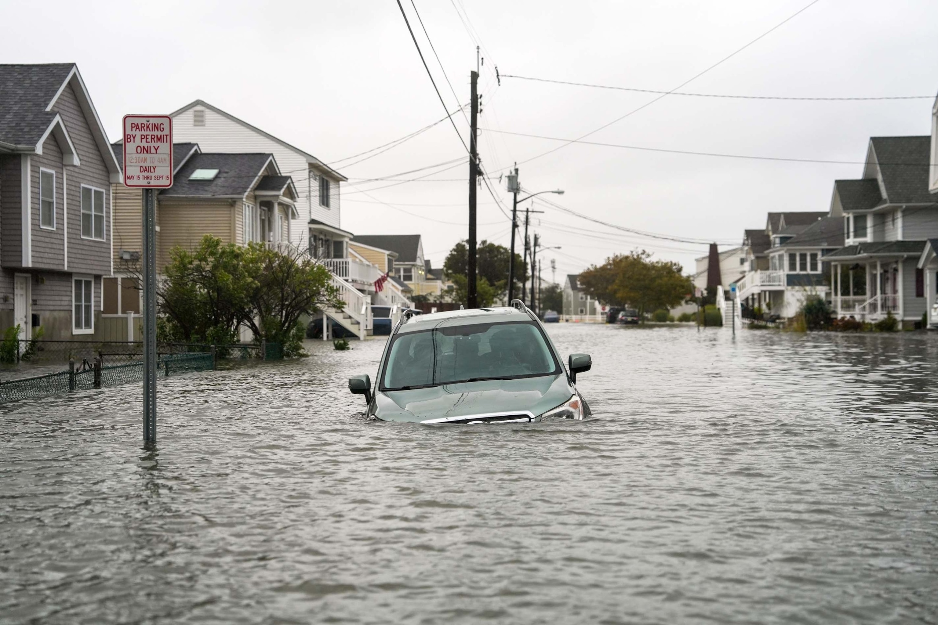
A car is seen submerged in water on a flooded road during a nor’easter storm where a voluntary evacuation has been issued in the community on Sept. 26, 2026, in Point Pleasant, New Jersey.
Ryan Murphy/Getty Images
High wind warnings are in effect for the Jersey Shore, as well as parts of Rhode Island and Massachusetts, including Boston, Providence and Atlantic City, for winds gusting up to 60 mph. The winds can knock down trees and power lines.
High waves of 6 to 12 feet or more will continue to pound the coastline from coastal Delmarva through the Jersey Shore, Long Island and southeastern coastal New England, producing widespread and potentially significant beach erosion and dangerous coastal conditions.
Popular Reads
Per police in Stafford Township, New Jersey, the Route 72 causeway into Long Beach Island has been closed to non-essential personnel.
According to the National Weather Service, evacuations were underway for hotels in the vicinity along Black Horse Pike in New Jersey earlier this morning. Parts of the Black Horse Pike are underwater in multiple places, resulting in the closure of the roadway.
Timing the nor’easter and impacts

A fallen tree branch covers a car in Brooklyn, New York, on Sept. 25, 2026, as a nor’easter brings rain and strong winds to the area.
WABC
On Saturday afternoon and evening, rounds of heavy rain and strong wind gusts will continue from Maryland to southern New York and begin stretching into southern New England. High tide around 9 p.m. could produce moderate coastal flooding, with some isolated major coastal flooding possible.
Overnight into Sunday morning, rounds of heavy rain and strong wind gusts will continue from Maryland to southern New England as several rounds of heavy rain will move through before sunrise, with isolated instances of inland flash flooding possible.
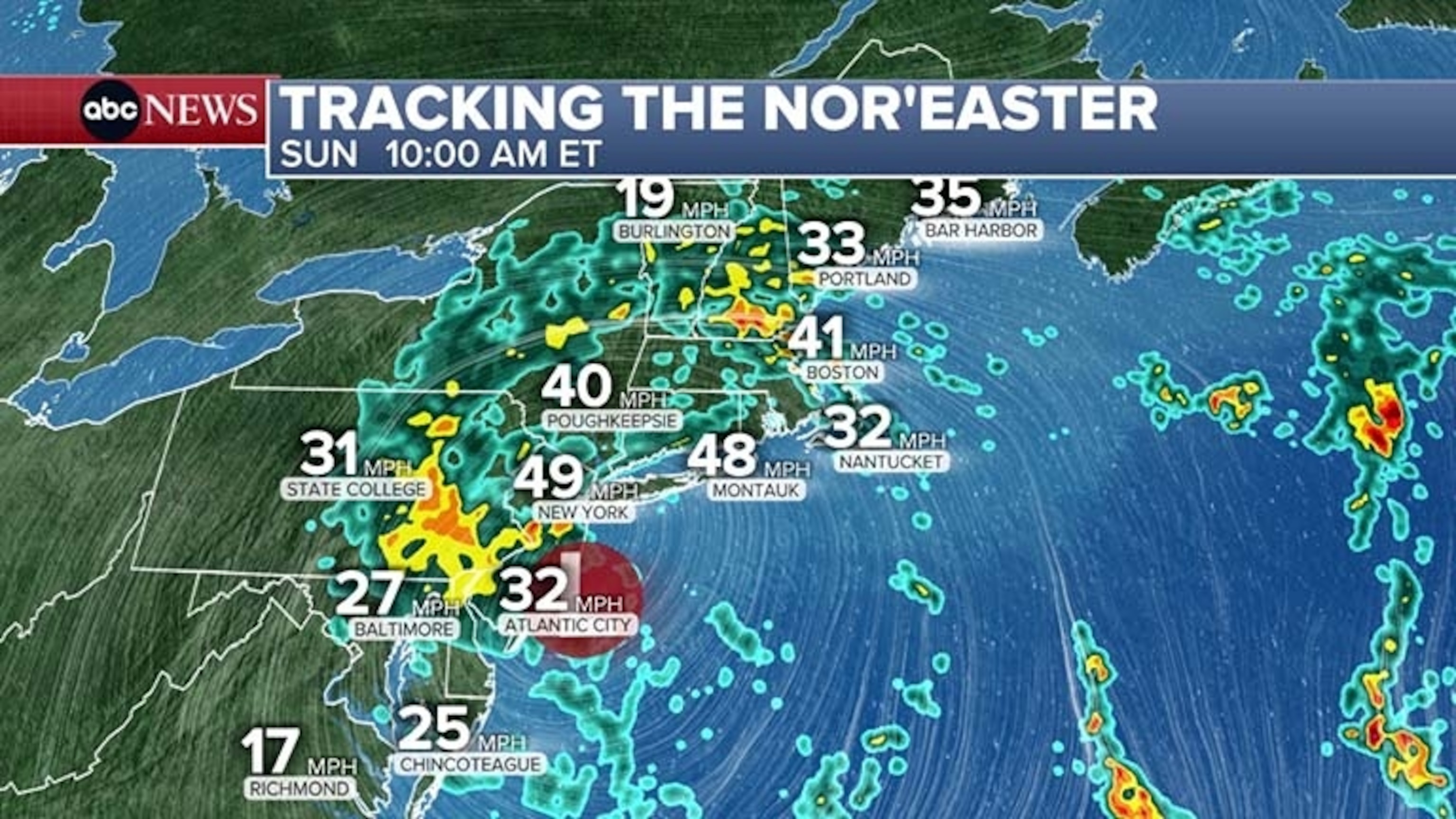
The nor’easter will continue to linger on Sunday but begin to break up and weaken. Winds and rain will begin to lighten, though gusty winds and some heavier pockets of rain will remain possible with potential lingering impacts into Monday.
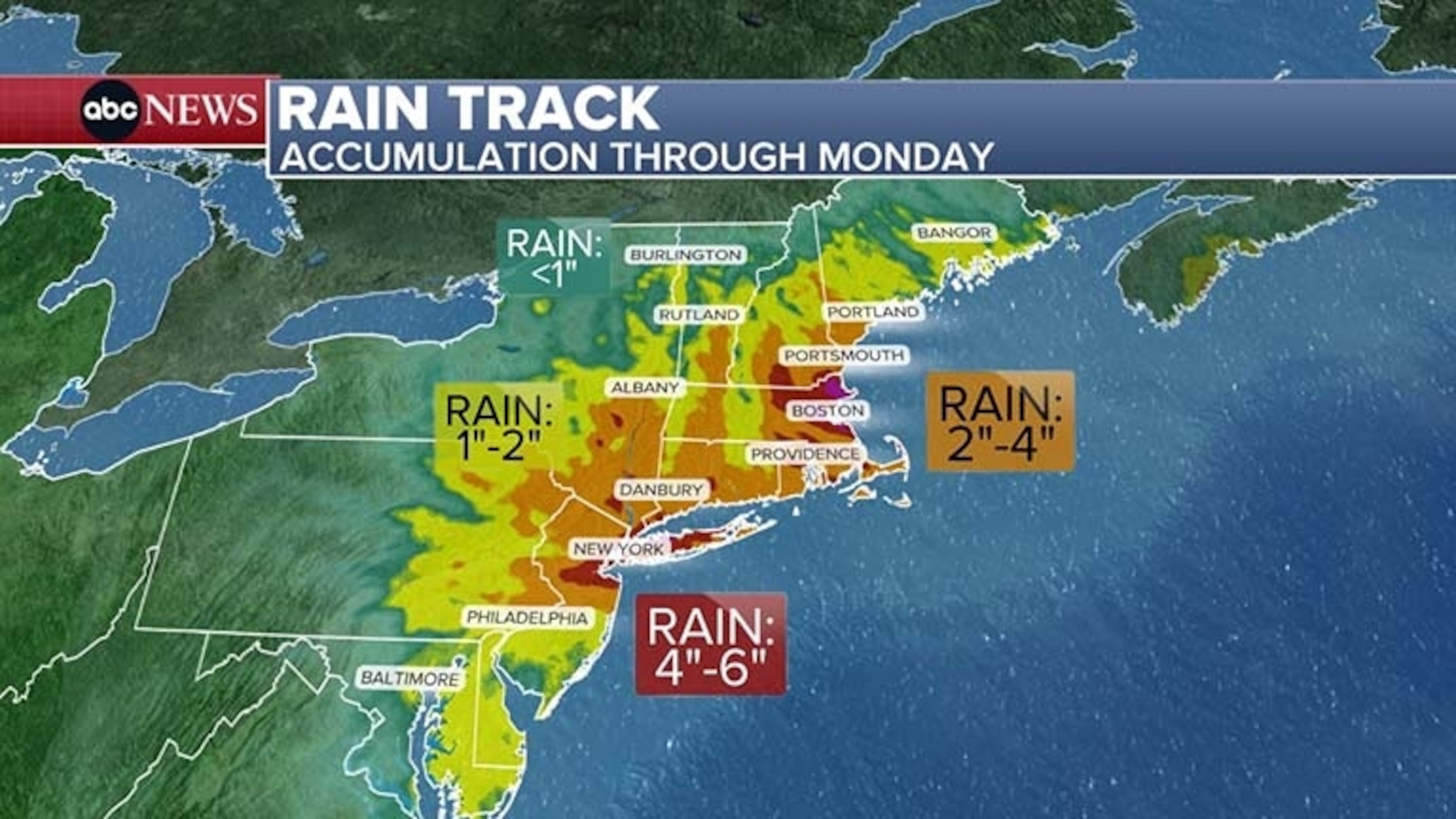
Rainfall totals will be widespread at 2 to 4 inches across the Northeast, with some of the highest totals reaching up to 6 inches from New Jersey to Boston.
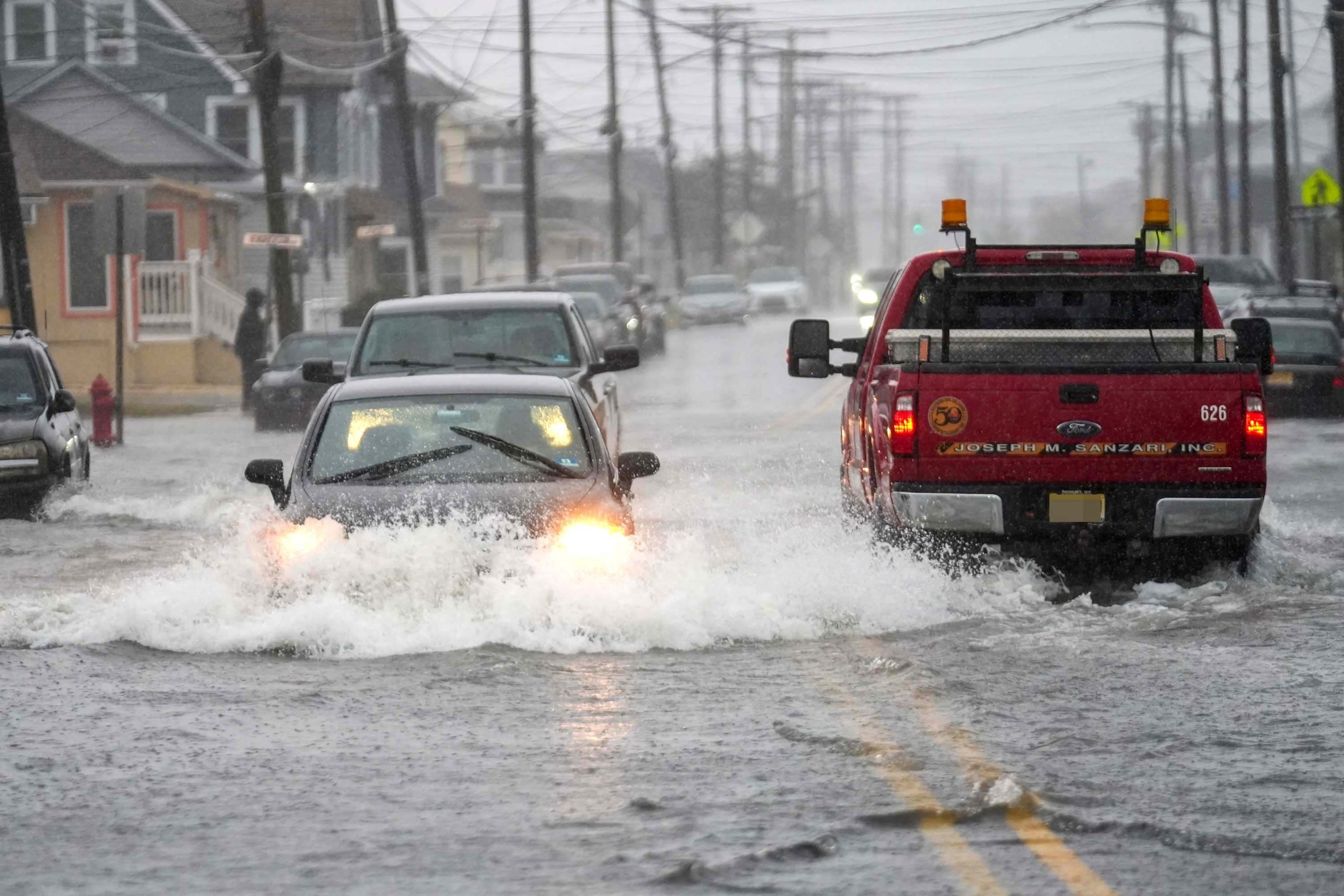
Cars drive through A flooded road is seen during a nor’easter storm where a voluntary evacuation has been issued in the community on Sept. 26, 2026, in Point Pleasant, New Jersey.
Ryan Murphy/Getty Images
Some inland flash flooding will be possible, especially in areas with poor drainage, where blown leaves can clog storm drains, or where the heaviest bands of rain move through.
However, because the rain is falling over such a long duration, inland flash flooding will not be the most widespread threat as wind-driven rain could instead lead to power outages.